Mount Magazine State Park
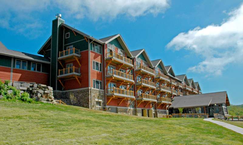
Lodge at Mount Magazine State Park

Lodge interior at Mount Magazine State Park

Lodge at Mount Magazine State Park

View from Mount Magazine State Park

Hiking Mount Magazine State Park

Views from Mount Magazine State Park

Rock climbing at Mount Magazine State Park
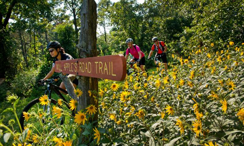
Will Apple's Road Trail at Mount Magazine State Park
What to know
At the peak of the state park experience is Mount Magazine, Arkansas’s highest point at 2,753 feet. People come for the sweeping views alone, but there is much to see and do from this unique spot. Mount Magazine State Park is a place of relaxation, exploration, nature study, and is within the Ozark-St. Francis National Forests. It is a destination for outdoor sports and extreme adventures with mountain biking, horseback riding, backpacking, and ATV riding. Mount Magazine is the state park system’s most dramatic location for technical rock climbing, and it’s one of only two parks to offer hang gliding launch areas. Scenic overlooks, hiking trails, picnic area, pavilion, and visitor center with gift shop add to the amenities. A wide variety of programs led by park interpreters highlights the mountain’s natural diversity.
The Lodge at Mount Magazine features 60 guest rooms, Skycrest Restaurant, a conference center, business center, heated indoor swimming pool, fitness center, and game room. From its setting on the mountain’s south bluff, the lodge offers breathtaking views of the Petit Jean River Valley and Blue Mountain Lake in the distance. Its beautiful setting and first-class facilities make the lodge a top choice for romantic getaways, weddings, conferences, and corporate retreats. The conference space can be divided into three meeting rooms or opened up for banquet-style seating for up to 192 people. Skycrest Restaurant seats up to 125. Thirteen cabins share the same view as the lodge. Choose from one-, two-, and three-bedroom options with fully equipped kitchens, fireplaces, and covered decks with outdoor hot tubs. There are also 18 campsites on the mountain (two Class AAA and 16 Class AA with tent-only options).
The Lodge at Mount Magazine features 60 guest rooms, Skycrest Restaurant, a conference center, business center, heated indoor swimming pool, fitness center, and game room. From its setting on the mountain’s south bluff, the lodge offers breathtaking views of the Petit Jean River Valley and Blue Mountain Lake in the distance. Its beautiful setting and first-class facilities make the lodge a top choice for romantic getaways, weddings, conferences, and corporate retreats. The conference space can be divided into three meeting rooms or opened up for banquet-style seating for up to 192 people. Skycrest Restaurant seats up to 125. Thirteen cabins share the same view as the lodge. Choose from one-, two-, and three-bedroom options with fully equipped kitchens, fireplaces, and covered decks with outdoor hot tubs. There are also 18 campsites on the mountain (two Class AAA and 16 Class AA with tent-only options).
Plan Your Adventure
Suites
Rooms include full housekeeping service, linens, refrigerator, satellite television, Wi-Fi, and coffeemaker. Suite is two rooms and include gas fireplace.
Single King Rooms
Rooms include full housekeeping service, linens, refrigerator, satellite television, Wi-Fi, and coffeemaker.
Queen Rooms
Rooms include full housekeeping service, linens, refrigerator, satellite television, Wi-Fi, and coffeemaker. Queen Standard rooms do not have balconies.
Cabins
Covered deck with outdoor hot tub and view from the bluff. The charge for each additional person is $12 per day. Children age 12 and under stay free.
- 1 Bedroom, 1 Bath — Cabin #: 2, 10, 11
- 1 Bedroom, 1 Bath (Dog-friendly)*** — Cabin #: 4
- 1 Bedroom, 1 Bath ADA — Cabin #: 7
- 2 Bedroom, 2 Bath — Cabin #: 1, 3, 5, 6, 8, 12
- 2 Bedroom, 2 Bath ADA — Cabin #: 9
- 3 Bedroom, 3 Bath ADA — Cabin #: 13
Class AAA - Water/50 Amp/Sewer
Contact the park for details
Class AA - Water/30 Amp/Sewer
Tent Campsites
Primitive Camping
Contact park for availability.
Group Pavilions, Open Pavilion
Standard Pavilion
Please contact the park for reservations and more information at 479-963-8502 or [email protected].
Per Day: $79.00
Contact park for availability.
Meeting Rooms
Visitor Center Meeting Room
Please contact the park for reservations and more information at 479-963-8502 or [email protected].
Per Use: $140.00
Contact park for availability.
16878 AR-309
Paris, AR 72855
Call The Park